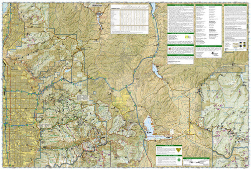
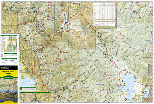
• Waterproof • Tear-Resistant • Topographic Map Coverage includes Uinta National Forest; Southern Wasatch National Forest; Twin Peaks, Lone Peak and Mt. Timpanogos Wildernesses; Spanish Fork, Soldier Summit, Cottonwood Heights, Kamas, Heber City and American Fork; Cottonwood, Mill Creek and Spanish Fork Canyons, Mirror Lake - West, Rockport Lake, Deer Creek, Currant Creek and Strawberry Reservoir. Includes UTM grids for use with your GPS unit.
By signing up, you agree to be tantalized by the best, wildest and gorgeousest that Utah has to offer. You automatically agree to never share any of the locals-only secrets you’ll receive concerning awesome hikes, bikes, peaks and fishing holes. And Utah.com cannot be held liable for lost wages if you quit your day job to go on a permanent road trip.
Choosing a selection results in a full page refresh.